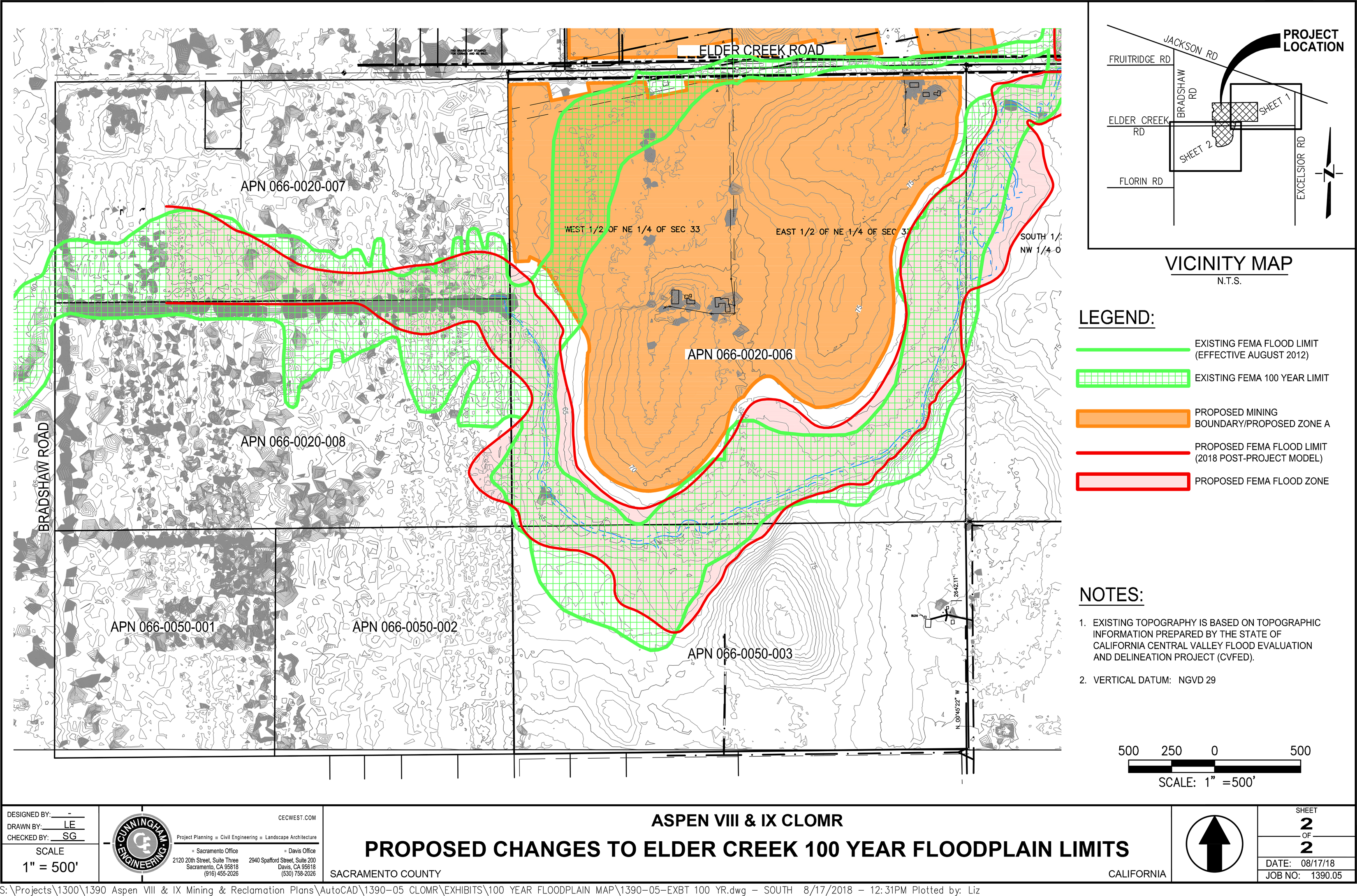
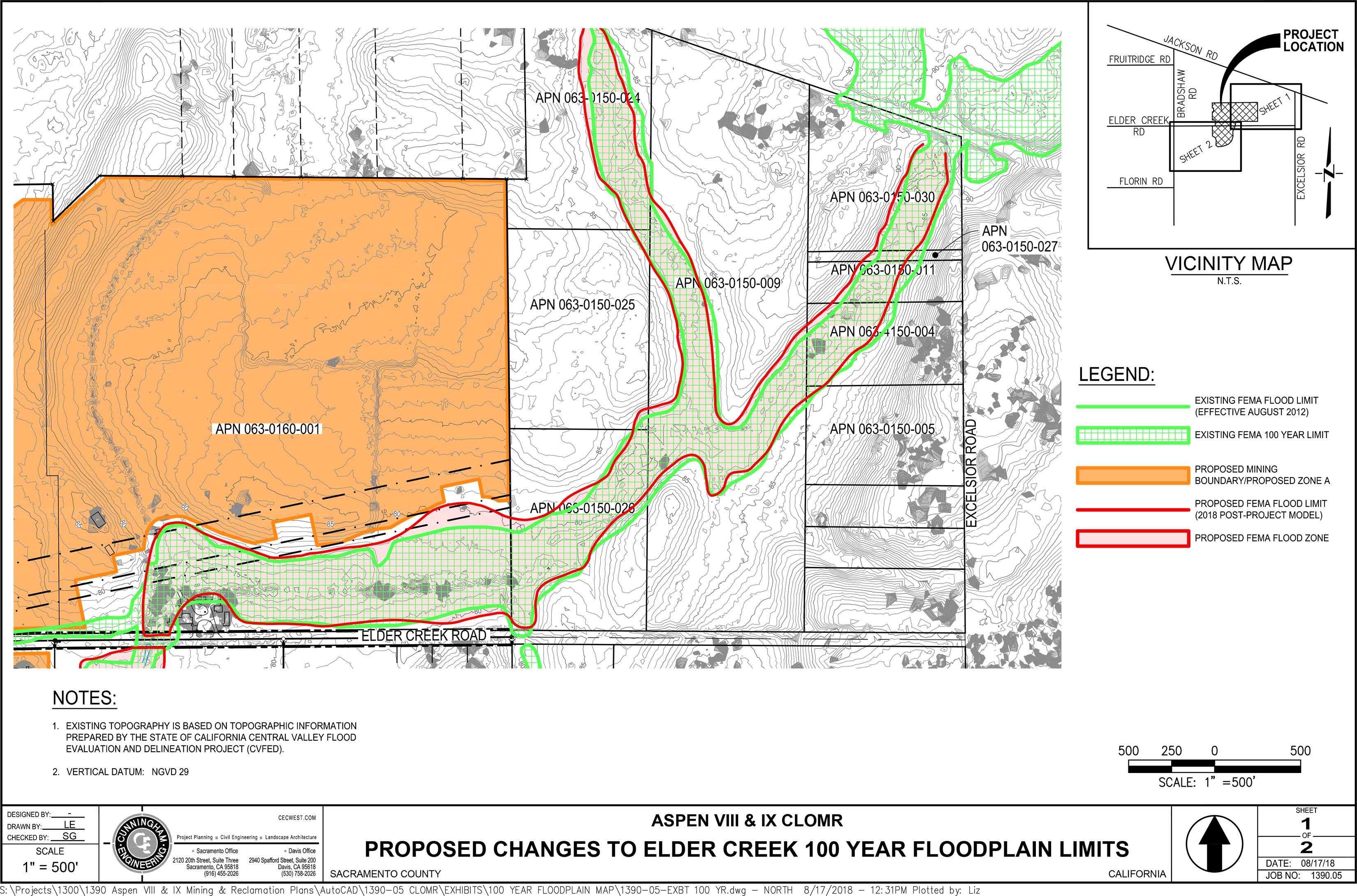
In accordance with the National Flood Insurance Program regulation 65.7(b)(1), Sacramento County hereby gives notice to affected property owners of the intent to revise the flood hazard information along Elder Creek from 1000 feet east of Bradshaw Road to upstream (east) to the west edge of Jackson Highway.
The Flood Insurance Rate Map (FIRM) will be revised to show the changes to the floodplain boundary and base flood (100-year) elevations. The FIRM is used to determine flood insurance rates and help the community with floodplain management.
Teichert Materials has applied for a Conditional Letter of Map Revision (CLOMR) from the Federal Emergency Management Agency (FEMA) to revise the FIRM Map for the County of Sacramento, California. The CLOMR results in establishment of Base Flood Elevations (BFEs) with a new 1% annual chance (100-year) floodplain designated Zone AE.
Teichert intends to replace the existing undersized culverts that currently allow Elder Creek to pass underneath Elder Creek Road with larger and more adequately sized culverts, and install a small side weir on Teichert’s property to accept and store certain high creek flows onto their property.
The purpose of the culvert replacement would be to increase the capacity of these culverts which will eliminate future road overtopping of the creek during flood events. The purpose of the weir would be to ensure that any downstream flood flows that could increase as a result of the improved capacity of the culverts are captured and stored within the mine pit, thus ensuring that there are no increased flood flows downstream of the Teichert Project.
Maps and detailed analysis of the proposed revision to the flood hazard information can be reviewed at the Sacramento County Department of Water Resources Office, Room 430, 827 7th Street, Sacramento, CA 95814. Interested persons may call Shayan Rehman at (916) 874-3768 or Windy Genov at (916) 874-3963 for additional information or to ask questions about the project or changes to the floodplain.
Map 1
Map 2