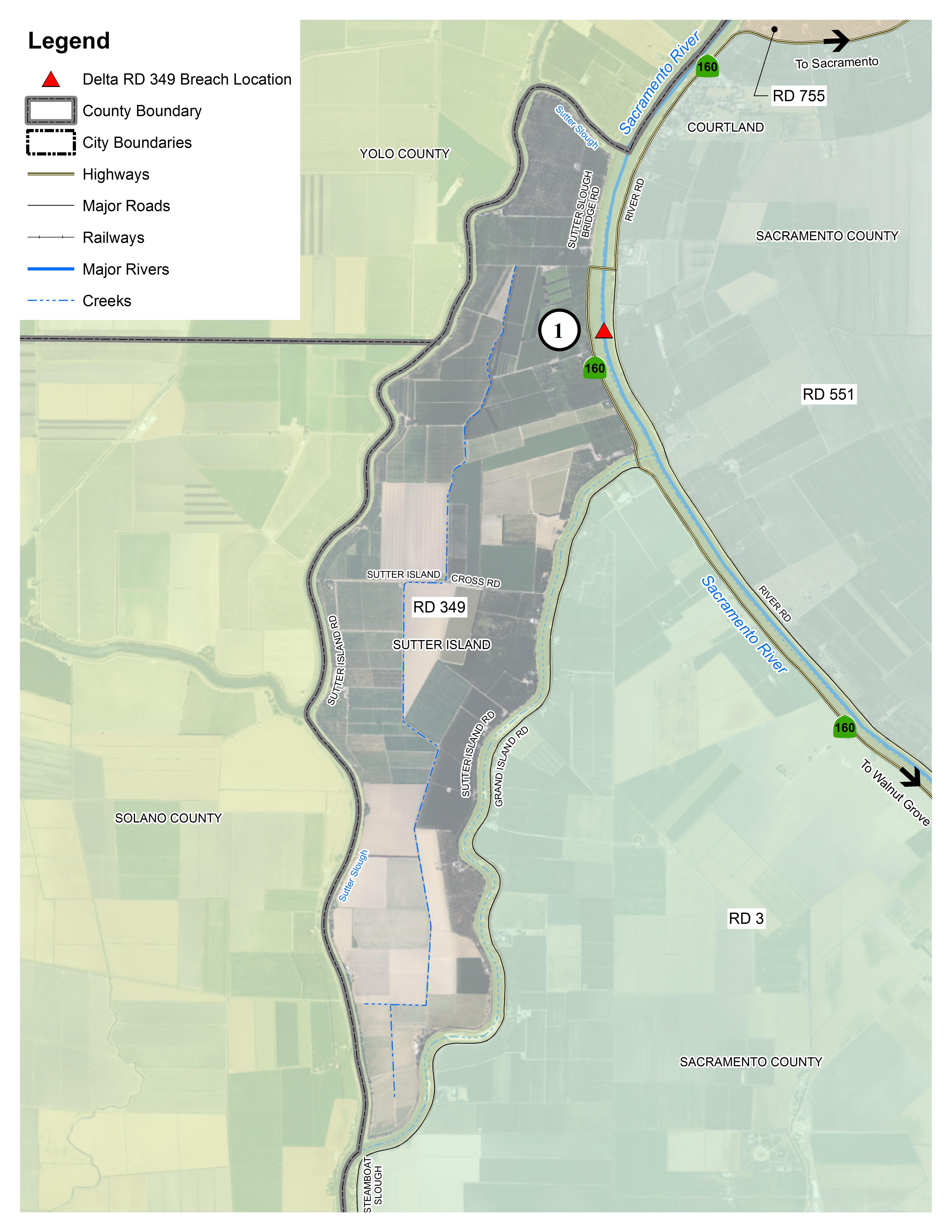
This map details the locations in the Delta within Reclamation District 349 where flooding could occur.
The red triangles denote potential levee breach locations. The chart below are links to flood depth and evacuation maps for each area.
Printable map